According to Wikipedia:
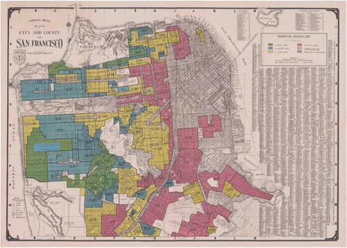
 Residential security map, 1937. This is the type of map that was used to redline communities. Notice any connection to today's racialized economic disparities?"Redlining is the practice of denying, or charging more for, services such as banking, insurance,[2] access to health care,[3] or even supermarkets,[4] or denying jobs to residents in particular, often racially determined,[5] areas. The term "redlining" was coined in the late 1960s by John McKnight, a sociologist and community activist.[6] It refers to the practice of marking a red line on a map to delineate the area where banks would not invest; later the term was applied to discrimination against a particular group of people (usually by race or sex) irrespective of geography."
Security Maps
Security maps were created to show real estate investors how "secure" their investment in certain neighborhoods would be. Definitions of "security"/"insecurity" often (exclusively?) followed race lines. That is, communities of color would often not have access to banks, grocery stores, and other basic community infrastructure in their neighborhoods. This is one of the contributing factors to such phenomena as food deserts (Oakland Wiki). So goes the intersection of race, resource in/access and socioeconomic mobility.
Historical examples of redlining in SF


